Adam Larson / Caustic Logic
The Frustrating Fraud
August 4 2007
rough draft
Released by the NTSB via FOIA request to Pilots for 9/11 Truth member Undertow in August 2006, the “csv file” is one of the more widely-cited sources of Flight 77 FDR information. It’s a huge file – offered by the Pilots for download:
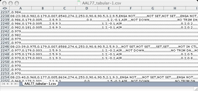
The CSV file, AAL77_tabular.csv (zipped): dowload link
A text list of the parameters plotted: dowload link
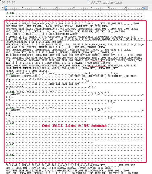
It’s a bitch to read. I had initially only been able to open the file as simple text file, with well over 300 values (I stopped counting) each represented in packed clusters for each second of the hour-and-a-half doomed flight, a total of nearly 4,700 frames. A single frame looks like this (highlighted in red is the data for the first frame at 8:19:00 am - the last frame is 9:37:44, ending as the animation does one second early):
Opening it in Excel, once I figured that out, helped little, as it doesn’t really organize the data into readable columns.
Each comma separates one of the myriad values from the next (hence the file type CSV, or “comma separated value”). Many many of them, where there are commas in a row, are blank or inoperative; the NTSB’s SFRI noted that even though “the recorder operated normally,” that report, and the CSV as well, included “only validated parameters.” The blank values, including the radio altimeter, “either were not recorded properly or were not confirmed to have been recorded properly.”
Most remain readable, but with so many values presented this way, the only way I can find anything is to have a good guess of the value I’m looking for (29.92, latitude, etc.) and do a search ‘till I find it. Out of this mess and my relative ignorance (and sporadic, stumbling tenacity), I’ve been able to verify a few oddities proposed by Undertow and his cohorts at P49T: the pressure altitude reset said to place the plane too high for impact, and the 20-mile longitudinal offset, which seems odd but irrelevant.
- I had misread the initial pressure altitude recorded and concluded the csv and animation altitudes in fact matched at the beginning, which they don't. Initial altitude reading: 40 ft msl, 250 feet underground at Dulles, 260 below the animation readout. A mess of a post... and a graph
- The numbers in the tabular csv file match the official story's flight path in latitude/longitude plots (once corrected) and timeline. Nothing new but another verification and a nifty new graphic.
- There seems to be a slight north offset as well, depending on if I'm reading this right. At any rate, the graphing of the csv final plots that helped me see this is interesting for its own reasons.


No comments:
Post a Comment