Adam Larson / Caustic Logic
The Frustrating Fraud
Sept. 1 2007
 This is to organize the few posts in which I have explored the internal geography - the scale and orientation of the grid beneath the plane, what seem to be latitude or longitude markers. It's not the most relevant line of inquiry, but I got interested and my analysis finalized, it's worth what it's worth.
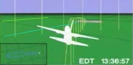
 As I started out, right off the runway I see an oddity: "the Elastic runway." (July 31) This one was pretty dumb. I let it drop as an illusion, but it is the first glimpse of the grid rotation that started popping up as I dug in.
PART 1: Ground Objects: Looking at the placement of origin (Dulles) and end (Pentagon) in relation to real-world latitude and longitude lines.
PART 2: Longitude Lines
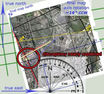
PART 3:Grid Clues: Orienation and proportion. (August 21) Itseems square and titled as if to magnetic north.
PART 4: Latitude Color Track (with video!)
PART 5: A turn for the worse: The culmination of my mapping work here: the north-of-the-Citgo flight path from the NTSB animation is shown once and for all to be the result of rotation from the real data and no more, and all those who've promoted it as evidence are shown to be fools.


No comments:
Post a Comment